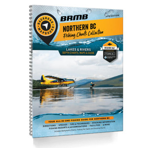
Larger than the entire country of Sweden, Northern BC is an immense sparsely populated region. The port city of Prince Rupert sits nestled among the majestic coast mountains in the west, acting as a gateway to the Pacific Ocean and the majestic islands of Haida Gwaii. To the east, the Rocky Mountains cast their imposing shadow over the land, attracting hikers, mountaineers and ski tourers from far and wide. Whether you are looking to fish, camp, ATV, snowmobile, hit a hot spring, view wildlife or just take in the sights, Northern BC offers an abundance of adventure.
The latest edition of our Northern BC Backroad Mapbook contains countless updates and additions to help you navigate this vast area. In addition to expanded road coverage, we have updated our motorized and multi-use trails, added more fish species to many lakes and rivers and included more Points of Interest. We have also included refined private land areas, an updated McBride area map and expanded our Adventures listings with additions to each section. There is a new Rock Climbing section, new Ocean bathymetry to the Pacific coast area of Northern BC and Haida Gwaii and an Overland subsection with a dozen routes described. The Community Profiles have been updated and refined to help feature the best areas to explore.
What's new for the 7th Edition Northern BC Mapbook
- Updated Adventure listings, Attractions and more
- Updated Road and Trail Coverage
- Updated and expanded Central and Northern Coast Ocean paddling systems including 100's of campsites, access, portages and day-use areas
- New Ocean bathymetry to the central and north Pacific coast area
- New Overland and ATV Routes
- New Rock Climbing Destinations
- Additional Fishing Lake stocking information and charts
- Updated and expanded the multi-use trail systems including Trail Charts for the bigger parks and cities
Our Mapbook Features
- Private Land
- Labeled fish species for fishing lakes
- National, Provincial and Regional Parks, Private Campgrounds and First Nation areas
- The most resource, industry, and logging road coverage available for Northern BC
- Hiking trail charts for major hiking areas (including Babine Mountain Park, Smithers and Tumbler Ridge)
- Stocking charts for the region's stocked fish species
- WMU boundaries for all 3 regions: Region 6 (Skeena), 7A (Omineca) and 7B (Peace)
- Easy to use Index and navigation information
- Comprehensive Community Profiles of the main centres up north
The printed version of the mapbook comes in the convenient 21.5 x 28 cm (8.5 x 11 inch) mapbook format with a heavy-duty spiral-bound cover. The 320 page book includes 116 maps starting at 1:250,000 scale, along with 13 Outdoor Adventure sections, a Service Provider Directory and Community Profiles, Map and Adventure Index, Trip Planning tools and more. With over 240,000 kilometres of roads to view including the most complete logging and industrial road coverage available, the books are ideal for navigating on road trips and planning from home.
FEATURES
Topographic Maps
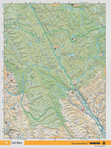
Covering almost half the province of British Columbia, this huge swath of land is only accessed by two main highways, both of which head north from Prince George but there are plenty of backroads running off these leading into pristine landscapes. In addition to the over 245,000 kilometres of roads including highways, rural roads, city roads, and logging and industry backroads, the latest edition of our Northern BC Backroad Mapbook contains many updates and additions. We have updated our motorized and multi-use trails, added fish species to many more lakes and rivers and included countless new Points of Interest. Crown and private land areas have been refined, the enhanced maps of the McBride area have been updated and more places to Adventure have been added to the maps. These include new Overland Routes and Rock Climbing opportunities.
- Map Key & Legend
- 59 topo maps @ 1:250,000 scale
- 27 topo maps @ 1:275,000 scale
- 28 topo maps of the north @ 1:550,000 scale
- 2 feature area (McBride) maps @ 1:250,000 scale
Detailed Adventure Section
Our detailed adventure section is one of the features that makes your Backroad Mapbook so much more than just a map of Northern BC. From hiking to hunting, ATVing, paddling, wildlife viewing and beyond, our team of writers and researchers have come up with the most comprehensive adventure information available anywhere for this region.
- 90+ Backroad Attractions
- Over 480 Fishing Hot Spots (Lakes, Rivers & Ocean)
- Hunting Wildlife Management Areas for Region 6 (Skeena), 7A (Omineca), and 7B (Peace)
- Over 70 Paddling Routes including lake circuits, whitewater routes and ocean kayaking areas
- Over 155 Parks & Campsites
- Over 250 BC Recreation Sites
- Over 365 Multi-Use Trail Systems
- 45+ ATV and Overland Routes
- Over 65 Snowmobile Areas with Restricted Areas highlighted
- Over 80 Wildlife Viewing Hot Spots
- Over 55 Winter Recreation Trails and Ski Areas
- 30+ Backcountry Hut & Cabin
- 9 New Rock Climbing areas
Service Directory
In addition to our maps, we list Northern BC accommodations, services, tours, and amenities, including information on the top outfitters in Prince George, Fort St. John, Haida Gwaii, Dawson Creek, Prince Rupert and the surrounding regions. We also list where to find hunting rifles and sportfishing equipment for sale in the area.
- Accommodations
- Sales & Services
- Tours & Guides
Index
In your Northern BC Backroad Mapbook you will find an easy-to-use Index divided into Adventure and Map sections. Each activity or geographic location has page and map numbers and we also include important contact information, distance charts and an advertiser list for easy referencing.
- Adventure Index
- Map Index
Community Profiles
Your northern BC Backroad Mapbook contains detailed written profiles on the region's major communities, including information on the best things to see and do in and around Prince George, Mackenzie, Chetwynd, Tumbler Ridge, Dawson Creek, Pouce Coupe, Hudson's Hope, Fort St. John, Vanderhoof , Fort St. James, Fraser Lake, Burns Lake, Cranisle, Houston, Telkwa, Smithers, Terrace, The Hazeltons, Kitimat and many others. New to this edition, we have added community profiles for McBride and Prince Rupert, as well as expanded the profiles for Prince George and Dawson Creek.
ADVENTURES
Backroad Adventures
No other BC map gets you out into the backcountry with confidence like this one to explore the truly special endless backcountry of the north. There are very special attractions in Northern BC communities like the Anyox Ghost Town, Nisga'a Lava Bedorth of Terrace, the Bear and Salmon Glaciers and countless hot springs, and no trip would be complete without visiting all the attractions of Haida Gwaii. Prince George, Atlin, Fort St. John, Dawson Creek, Terrace and Smithers also offer many heritage sights and attractions. With enough virgin wilderness to spend a lifetime exploring, our maps keep you on track with the best backcountry adventures, from the Grand Canyon of the Stikine to the Tumbler Ridge dinosaur footprints and Shipyard-Titanic boulder gardens. Our Backroad Adventure section has been refined and expanded for this edition and includes close to 100 incredible natural and man-made backroad attractions.
Fishing Adventures
From BC's largest lake, Williston Lake, to the literally hundreds of other untouched lakes and rivers teeming with fish, Northern BC offers some of Canada's best fishing. Lake anglers will find information on countless lakes such as Atlin Lake, Babine Lake, Boya Lake, Burns Lake, Carbon Lake, Cold Fish Lake, Francois Lake, Fraser Lake, Klinger Lake, Lakelse Lake, Nadina Lake, Nukko Lake, Ross Lake, Tagish Lake, Tommy Lakes, Tuchodi Lakes, Wasi Lake and Wapiti Lake. Similarly, the major river systems and their tributaries are featured including the Bulkley River, Dease River, Iskut River, Liard River, Moberly River, Nechako River, Pine River, Skeena River and Stikine River. Adding to the mix are ocean fishing areas for such areas as DFO Area 1 and 101 Graham Island Haida Gwaii, through to Area 6 Kitimat-Kemano Bay. Indeed, your Northern BC Mapbook contains almost 500 descriptions of the best fishing lakes, rivers and ocean hotspots, plus tips on the best BC fish species and how to catch them. Also included in this edition, are fish stocking charts for brook trout, cutthroat trout, kokanee, lake trout, rainbow trout and salmon, along with descriptions of the main sportfish.
Hunting Adventures
From rain-soaked coastal forests to prairie grasslands, high alpine and sprawling stands of spruce and pine, Northern BC boasts a wide range of big and small game habitat that creates some of the country's finest hunting opportunities. Our Hunting Adventures section has been updated and expanded, with detailed descriptions of the region's big game species and breakdowns of each WMU (Wildlife Management Unit) in Region 6 (Skeena), Region 7A (Omineca) and Region 7B (Peace), including notes on Limited Entry Hunting. In addition to information on the BC hunting regulations, we have included descriptions and tips on how to hunt the main big game species in the area. From the Skeena-Bulkley region to the Omineca Mountains, Fraser River Basin and the Peace Agricultural Zone, we've got you covered.
Paddling Adventures
The paddling section of our map book uses a modified version of the International River Classification System to mark the scenic waterways throughout Northern BC. From the paddling in Gwaii Haanas National Park in Haida Gwaii - some of the world's most sacred and renowned ocean paddling - to the Nechako River and the dozens of small rivers that snake through the north of BC, our Paddling Adventures section details over 70 paddling routes. Featuring popular and out-of-the-way locations, readers will find details on routes such as Alsek And Tatshenshini Rivers, Bonny Lake, Dease River, Grenville Channel, Morice-Atna Canoe Route, Nanika-Kidprice (Nenikekh, Nation Lakes, Portland Inlet, Spatsizi and Stikine Rivers, as well as the Takla-Stuart Lake Route, Whether whitewater paddling or gliding peacefully across a lake, we offer everything you need to know about canoeing and kayaking in Northern BC.
Park Adventures
One of the best ways to explore Northern BC is through the region's many provincial parks. Your Northern BC Mapbook lists over 155 parks throughout the region, including Gwaii Haanas National Park, replete with First Nations history, and Khutzeymateen Provincial Park, where you will find the province's greatest number of grizzly bears. Other parks found here include Anhluut'ukwsim Laxmihl Angwinga'asanskwhl Nisga'a (Nisga'a Memorial Lava Bed), Babine Mountains, Carp Lake, Gwaii Haanas National Park Reserve, Lakelse Lake, Lava Forks, Monkman, Mount Edziza, Purden lake, Spatsizi Plateau, Stone Mountain, Swan lake, Ta Ch'ila Park (Boya Lake), Tweedsmuir North as well as Tyhee Provincial Park. Each listing notes the map coordinates, amenities and area activities while providing information on access, campsite size and season, park highlights and more. Let us show you the beautiful backcountry around Prince George, Fort St. John and beyond like you've never seen it before!
Rec Site Adventures
Those looking for the best of BC camping need not look further. Rec sites offer a more rustic way to camp out in BC's backcountry than formal provincial campgrounds. Your Northern BC Mapbook lists over 250 BC recreation sites that feature and highlight the amenities and activities in the area, access and popular attractions that were developed by forestry workers and are now maintained by BC's Ministry of Tourism. From the Agate Point Picnic Site to the Wright Lake Rec Site, we put it all on the map.
Trail Adventures
The gorgeous region covered in these maps is a hike's dream. In the wild backcountry that stretches beyond Mackenzie, Prince George, Fort St. John, Haida Gwaii, Dawson Creek, and Prince Rupert, you will find an unbelievable abundance of trail systems. From the expansive network of trails through Babine Mountains, the East Beach Trail on Haida Gwaii, the challenging Mount Edziza Plateau Traverse in the northeast, Teetering Rock Trail by Fort Nelson and the Mineral Licks Trail at Muncho Lake, this Mapbook provides you with detailed information on over 365 multi-use trails, plus expanded trail charts for Babine Mountain Provincial Park as well as the areas around Prince George, Smithers and Tumbler Ridge.
ATV Adventures
With dramatic mountain terrain, endless backcountry, abandoned logging roads and mining sites, Northern BC is truly ATV country. Bigger communities like Prince George, Fort St. John, Dawson Creek and Prince Rupert offer tours, rentals, dealerships and often an ATV club. Our ATV Adventures section has been greatly refined and expanded from the last edition, with details of over 45 of the region's best trails and riding areas, including popular systems such as around Fort St. James, Hudson Hope, McBride, Sibola Peak, Telkwa Pass, Tabor Mountain and Tumbler Ridge. In addition, our new Overland subsection features 12 trip options ranging from easy highway rides to rugged backcountry excursions.
Snowmobile Adventures
From the Coast Mountain snowfields near Terrace, east to McBride in the Canadian Rockies, and through the communities of Chetwynd, Tumbler Ridge and the Peace River area, Northern BC is a snowmobiler's paradise. The latest edition of this mapbook includes a refined and expanded Snowmobile Adventures section, with over 65 listings for the best trails and riding areas complete with access information, distances, elevation gains, highlights and more. From the Babine Mountains and Burns Lake areas north to Fort Nelson and east of the Prince George area, hot spots like Bickford Mountain, Morfee Mountain, Paradise Valley, Pine Pass and beyond, are just a sampling of some of the best snowmobiling destinations showcased on these maps.
Wildlife Adventures
Northern BC is an expansive, wild area where Mother Nature rules the backcountry, from the foothills of the Northern Rockies to the rainforests of the Queen Charlotte Islands. Wild creatures roam in abundance, most notably moose, deer, elk, mountain goats, grizzlies and black bears. The latest edition of our Northern BC Mapbook contains a refined and expanded Wildlife Adventures section with over 80 listings for the best places to see wildlife in the region, including Cecil Lake Ecological Reserve, Muncho Lake, the Tumbler Point Bird Sanctuary and more!
Winter Adventures
Northern BC is a west coast winter wonderland. Throughout the backcountry around Bulkley, Prince George, Fort Nelson, Fort St. John, Haida Gwaii, Dawson Creek, Prince Rupert and beyond, you will find endless opportunities for winter fun, and our maps break them all down for you. Grab your map and hit the trail for snowmobiling, cross-country skiing, snowshoeing, fat biking, dog sledding, backcountry skiing in the northwest and east and more - we've got you covered with almost 55 options, from the winter trails in Babine Mountain Provincial Park to the slopes of the Powder King Ski Resort!
Backcountry Hut & Cabin Adventures
Back by popular demand, this edition of the Northern BC Backroad Mapbook lists over 30 backcountry huts and cabins with information on access, facilities and contact details for booking where applicable. This edition provides you with detailed information on the best places to take shelter or spend a comfy night in the backcountry throughout the region. From the Tabor Mountain Cabins near Prince George to the Hankin Lookout Cabin near Smithers and the cabins in Sugarbowl Grizzly Den Provincial Park, these maps show it all.
Rock Climbing
Added to the 7th edition of the Northern BC Backroad Mapbook is a new bonus section for Rock Climbing Adventures. In this new Backroad Mapbook Adventures section, we have featured 9 rock climbing areas, complete with details on access, difficulty and more, for the north.


